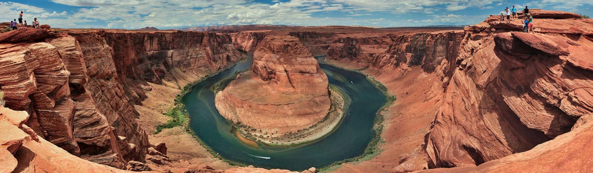
Horseshoe Bend, Page, AZ
Horseshoe Bend is a horseshoe-shaped incised meander of the Colorado River located near the town of Page, Arizona, in the United States.
Horseshoe Bend is located 5 miles (8.0 km) downstream from the Glen Canyon Dam and Lake Powell within Glen Canyon National Recreation Area, about 4 miles (6.4 km) southwest of Page.
The overlook is 4,200 feet (1,300 m) above sea level, and the Colorado River is at 3,200 feet (980 m) above sea level, making it a 1,000-foot (300 m) drop.
Camping near Horseshoe Bend: The National Park Service operates three campgrounds in this area
Google Map of Horseshoe Bend Location
34.108111, -110.677618

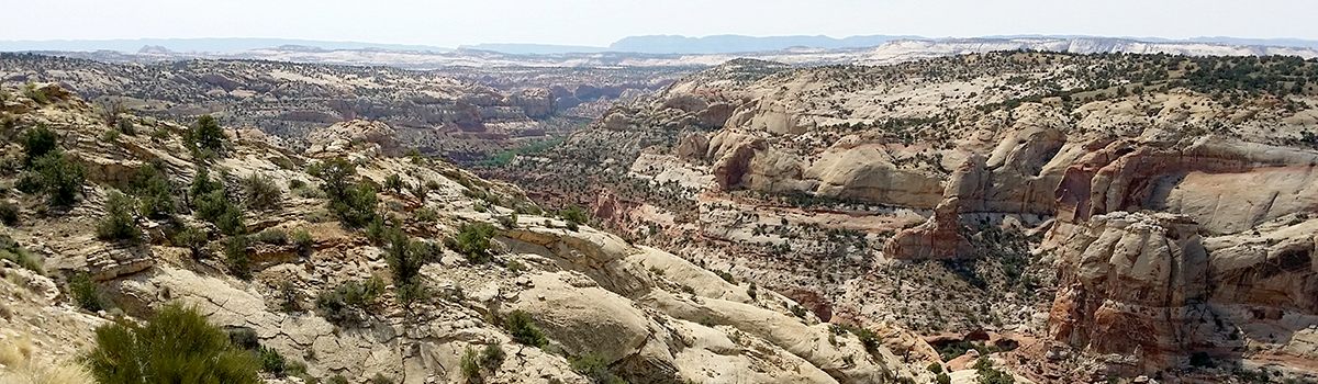
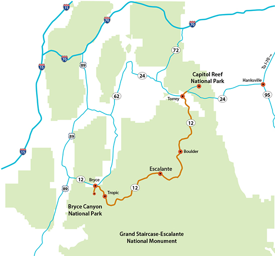 Utah’s Scenic Byway 12 begins in Panguitch in the west and ends in Torrey to the northeast. It can be enjoyed by driving either east or west — or both, multiple times. The road is open year-round, but after major winter storms, sections might be impassible until plowed, and ice can make some sections white-knucklers especially on the Boulder Mountain stretch during the winter. There are no fees to drive on Highway 12, although some destinations and attractions along the way — off of the highway — have an entrance fee. Feel free to bring a dog, but most areas and trails along the highway require the pup to be on leash. Don’t make the mistake I did once – I drove this stretch at night with a friend. We knew it had to be amazing, but had no idea what we were not seeing. Now that I have seen how spectacular this drive is, I really owe that person a drive. I would be happy to make this trip a hundred times.